


El Nino drags monsoon
2% rain deficit in country
According to the IMD had forecast August rainfall is probable to be ‘below normal’ ranging amidst 90% and 94% of the long period average,
At the end of July, from 5% excess rain at the end of July, a weak monsoon spell in August has led to a 2% rain deficiency across the country as per
India Meteorological Department on August 13.
The June-September rainy season is very much important for the country’s agriculture, which has an 18% share in India’s GDP at current (inflation-unadjusted) prices
Last week, as per IMD, the monsoon entered a weak phase which as per experts is a typical impact of El Nino. The IMD’s extended range forecast indicates a temporary revival of rainfall only over central India after August 18 but dry conditions in early September.
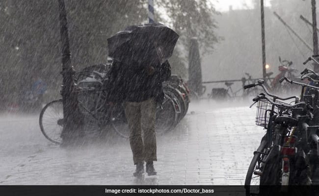
Although, most parts of the country remained dry during the past seven days, the Himalayan foothills including the northern states of Uttarakhand and Himachal Pradesh and the northeastern states recorded very heavy rain, leading to floods and several incidents of landslides.
Notedly, the weather in Himachal is that heavy rains has triggered landslides, road block. MD issues orange alert
This is primararily owing to the monsoon trough lying to the north of its normal position.
It is likely to be north of its normal position or along the foothills of the Himalayas during the next 4-5 days and gradually shift southwards towards its normal position thereafter.
Reportedly, there is a 2% rain deficiency over the country with 19% deficiency over east and northeast India; 15% excess over northwest India; 2% excess over central India and 8% deficiency over the southern peninsula.
Parts of east India, particularly the paddy growing regions of the Indo-Gangetic plains, continue to record a rain deficiency with Gangetic West Bengal recording a 29% deficiency; Jharkhand 37%; Bihar 28%; and Nagaland, Manipur, Mizoram and Tripura 24%
There is 42% rain deficiency over Kerala and Mahe; 20% deficiency over south interior Karnataka, and 22% over the Rayalseema region.
IMD forecasts of a possibility of a temporary revival of the monsoon around August 18.
All said, it is the second half of August which may see slightly better rainfall activity than the first half. IMD further informs that they are seeing the impact of El Nino.
According to DS Pai, senior scientist at the IMD, climatologically in the midst the first ten days of August the probability of recording break monsoon conditions is higher. The Madden Julian Oscillation position which was favourable in July is unfavourable now, there is an anomalous downward motion (instead of upward, which helps convection) over the western part of the country. All these together have weakened the monsoon.
In the midst of break in monsoon, the trough moves northward and spells heavy rain over the foothills, which is precisely why the Himachal Pradesh and Uttarakhand are recording very heavy rain. This was well predicted.
Skymet Weather predicts that they are seeing typical El Nino impact. The monsoon is unlikely to revive in full scale for the next 10 days. There is likely to be a brief spell of rain over northwest India around August 15 and 16. During the same time some rainfall can be expected around Chhattisgarh, Odisha, east MP, Bihar, etc.
But then the monsoon trough will shift to the north again, leading to dry conditions over the plains. We cannot expect conditions to improve much in August.
The June-September rainy season is important for the country’s agriculture, which has an 18% share in India’s GDP at current (inflation-unadjusted) prices. Nearly half of kharif or summer-sown areas don’t have irrigation cover, making the monsoon critical.
Abhishek Agrawal of Comtrade, a commodity trading firm attributes the rains swung from deficit to surplus in July, accelerating sowing which has surpassed last year’s levels. “Most farming states, except those in eastern India, got good rainfall in July. This rescued crops. Currently eastern Indian states are receiving heavy rainfall even though there may be an all-India deficit,” said Abhishek Agrawal of Comtrade, a commodity trading firm.
In July, rains had been scanty in eastern Uttar Pradesh, Bihar, West Bengal, Chhattisgarh and Jharkhand, with near-drought conditions in some pockets, while northwest India witnessed flooding. Eastern India is a predominantly paddy growing region, contributing to two-thirds of the country’s annual rice output. Farmers have sown 32.8 million hectares till August 11 with rice, the main summer staple, up 5.1% from the same period last year, according to the latest farm ministry data.
A normal monsoon is critical to put a lid on food inflation. Among non-perishables, wheat, rice and coarse cereals have witnessed double-digit inflation for past six months. Ample rains are also necessary to cool high vegetable prices.
Although kharif crops are now in good condition, the “full impact of El Nino is yet to play out”, said Dharmakirti Joshi, chief economist at Crisil Ltd. If the monsoon doesn’t pick up in another two-three weeks, kharif crops in some states could come under pressure. “Monsoon volatility has been higher this year compared with the normal historical average and the immediate past five years,” Joshi said.
The weak monsoon spell is also leading to meteorological drought-like conditions over several parts of the country. THe IMD’s cumulative standard precipitation index (SPI) from June 1 to August 9 shows 3% of India’s districts in “extremely dry” category mainly over east and northeast India and over south India; 6% in “severely dry” category and 9% districts in “moderately dry” category over the same region. The Standardized Precipitation Index (SPI) is the most commonly used indicator worldwide for detecting and characterising meteorological droughts. The SPI is used for estimating wet or dry conditions based on the precipitation variable. It mainly reflects soil moisture and rainfall conditions for a particular location.
According to Rajeevan, former secretary, ministry of earth sciences Drought monitoring by the India Met Dept Many districts are now under moderate or severe dry categories. Around next week, conditions may improve over Bihar, parts of WB, but likely to deteriorate over rest of country,” tweeted M Rajeevan, former secretary, ministry of earth sciences, on August 11.
On August 10, the National Oceanic and Atmospheric Administration in its El Nino Southern Oscillation bulletin said El Nino conditions are expected to intensify further.
“The most recent IRI plume (model) indicates El Niño will persist through the Northern Hemisphere winter 2023-24. Given recent developments, forecasters are more confident in a “strong” El Niño event, with roughly 2 in 3 odds of an event reaching or exceeding 1.5°C for the November-January seasonal average in Niño-3.4 (strong phase). Note that a strong El Niño does not necessarily equate to strong El Niño impacts locally, with the odds of related climate anomalies often lower than the chances of El Niño itself.
Skymet Weather on Saturday said that “a strong El Nino is emerging in the Pacific waters. ENSO is likely to push and impact monsoon rainfall during the 2nd half of season. Indian Ocean Dipole may still fall short of neutralising ill effects of El Nino.
El Nino conditions are expected to intensify this month according to IMD. El Nino has a strong influence on the southwest monsoon in India.
El Nino is characterised by an unusual warming of waters in the eastern equatorial Pacific, which has a high correlation with warmer summers and weaker monsoon rains in India. Positive IOD on the other hand is good for the southwest monsoon over India. IOD refers to the temperature differential between the western and eastern Indian Oceans.
A positive IOD has a direct correlation with a good monsoon.
The IMD has warns that isolated extremely heavy rainfall (over 20cm) is likely over Uttarakhand during next 2 days and isolated heavy rainfall is likely over Himachal Pradesh, Punjab, Haryana, Chandigarh, Uttar Pradesh, Bihar, Sub Himalayan West Bengal and Sikkim.
“This weak spell may continue till 19/20 August. Subsequently, models suggest a slight increase in rainfall activity. Not likely for long. September will be key. EL Niño is impacting the Indian monsoon.
News Edit K.V.Raman
